|
|
|
|
|
|
|
|
|
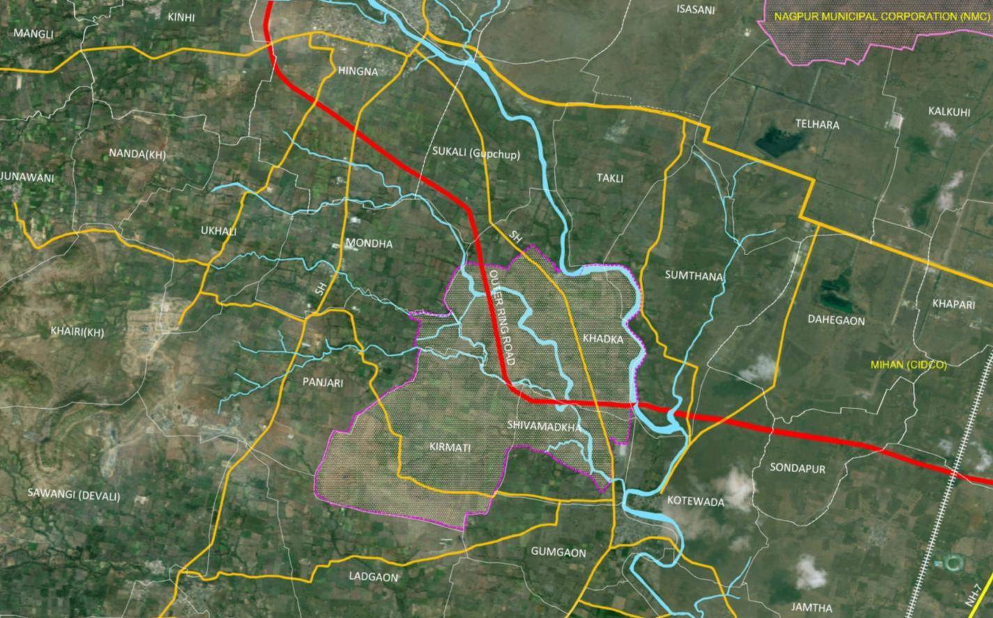
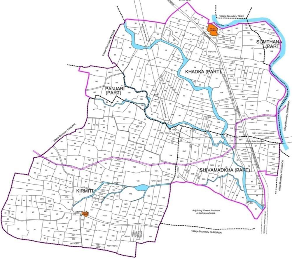
1. Approximate area: 9.58 sq km |
|
2. 5 villages as indicated in the table below: |
| No |
Village |
Area(sq Km) |
Land Parcels |
| 1 |
Khadka |
3.54 |
166 |
| 2 |
Kirmiti |
4.24 |
202 |
| 3 |
Shivmadka |
1.31 |
71 |
| 4 |
Panjri |
0.34 |
10 |
| 5 |
Sumthana |
0.15 |
5 |
|
Total |
9.58 |
454 |
|
|
|
3. Boundaries : |
|
a. NE - Vena river |
|
b. N - Khadka village |
|
c. NW – Mondha village |
|
d. W - Panjari village |
|
e. S - Gumgaon village |
|
|
4. North – South distance: 3.8 km |
|
5. East – West distance: 4.3 km |
|
|
|
1. Just outside NMC boundary
2. Along the Ring Road and Hingna State Highway
3. Close to MIHAN
4. Almost 40% of the land is under few ownerships.
|
|
|
|
|
|
|
|
|
|
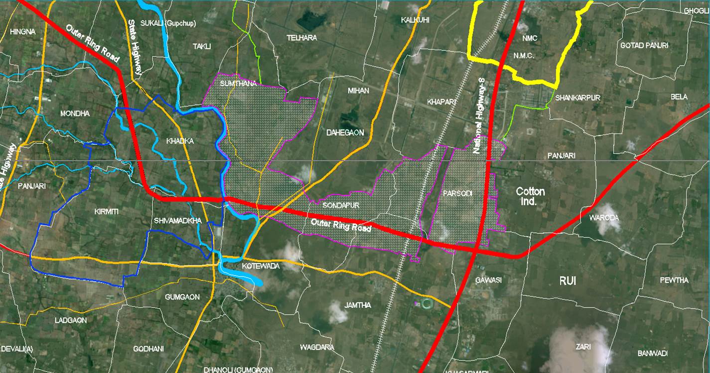
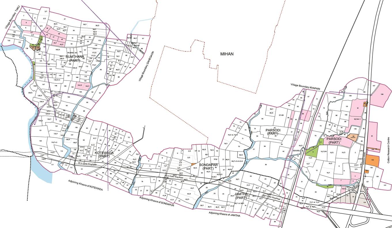
1. Approximate area: 10.29 sq km |
|
2. 5 villages as indicated in the table below: |
| No |
Village |
Area(sq Km) |
Land Parcels |
| 1 |
Sumthana |
3.44 |
224 |
| 2 |
Kotewada |
0.94 |
62 |
| 3 |
Sondapar |
1.50 |
93 |
| 4 |
Jamtha |
1.02 |
68 |
| 5 |
Parsodi |
3.38 |
208 |
|
Total |
10.29 |
655 |
|
|
|
3. Boundaries : |
|
a. W - Vena river |
|
b. N - MIHAN |
|
c. E – Cotton Research Center |
|
d. S – Jamntha, Sondapar, Kotewada Village |
|
|
4. North – South distance : 2.8 km to 0.6 km |
|
5. East – West distance : 6.5 km |
|